By Peter Montague
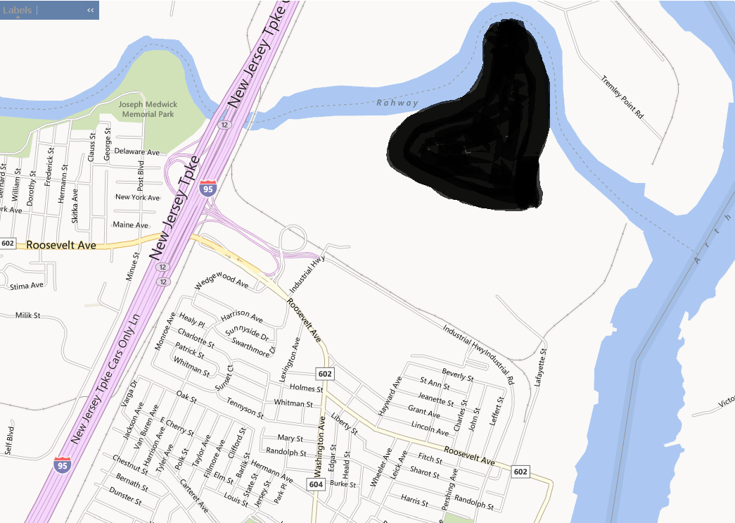
The Christie administration has signed off on a plan to dump millions of tons of contaminated soil on an 85-acre site sandwiched between the Rahway River on the north and an EJ community in Carteret on the south. Here are two maps that tell the story.
On the first map, the black blob is the proposed toxic dump. The wide purple strip to the left of the proposed dump is the New Jersey Turnpike. The blue band snaking across the top of the map is the Rahway River; the wide blue band on the right is the Arthur Kill, the body of water the separates New Jersey from Staten Island. The area showing streets in the middle of the map, just below the proposed toxic dump, is Carteret, NJ. Both maps were created using the federal Environmental Protection Agency’s web site called EJview.

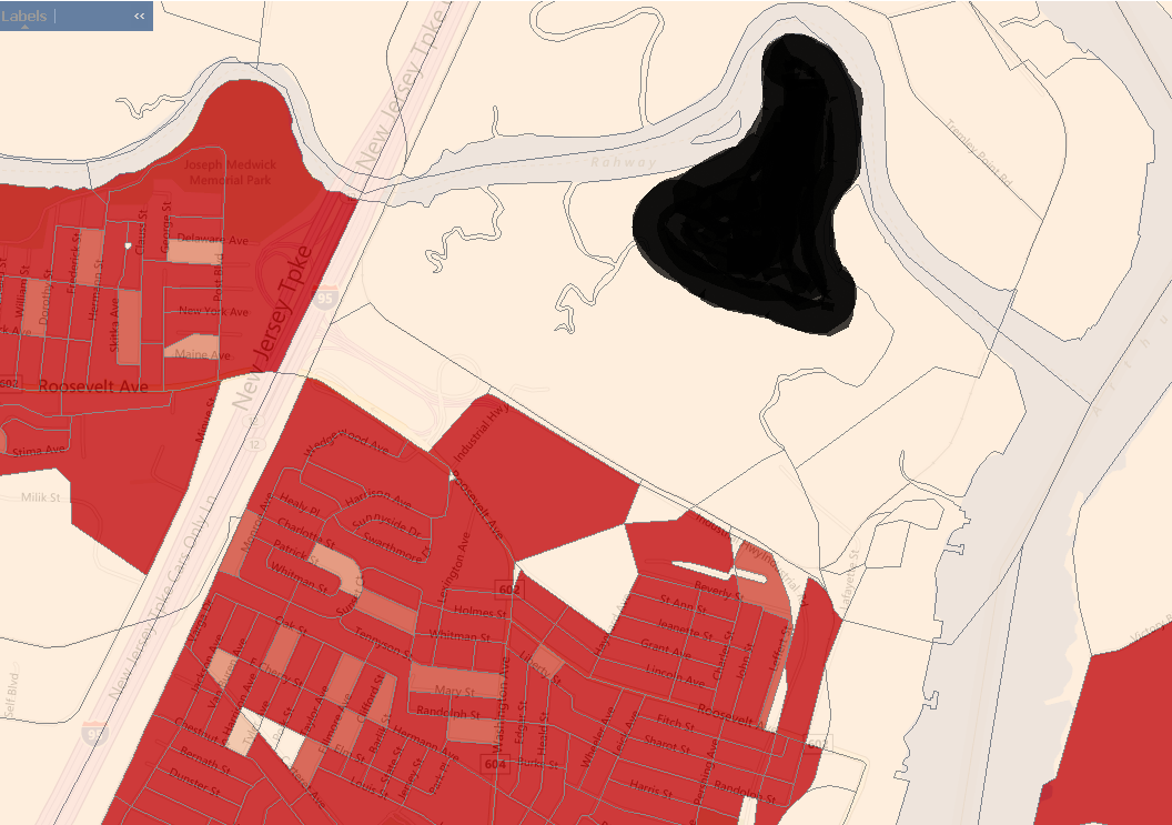
Now here is a map showing the proportion of people of color who live in this part of Carteret. The dark red color indicates where the population is more than 40% Of Color.

The plan is to bring contaminated soil to the site by diesel-powered dump trucks — at least 40,000 trucks per year will enter the site via Exit 12 from the New Jersey Turnpike.
A story in the New York Times Feb. 24, 2014 reveals how many New Jersey politicians stand to profit from this deal, starting with the Governor, on down through the ranks of both parties, including state Senator Bob Smith (Democrat), state Senator Ray Lesniak (Democrat), and state Senate President Stephen M. Sweeney (Democrat).
A company from Maryland — Soil Safe, Inc. (gotta love the name!) — will be dumping petroleum-contaminated soil onto the site for five years, creating a mound 29 feet tall on a piece of land subject to routine flooding.
Of course it is the Governor’s team at the N.J. Department of Environmental Protection — led by Robert Martin — that is providing the “scientific” cover for this political plum.
When the Governor’s team “reaches across the aisle” there’s a fistful of profits to be shared all around — by everyone except the neighborhood that’s going to sacrifice its quality of life, and perhaps its health, to keep the toxic Payola flowing.
[In an earlier version of this story, the proposed toxic dump was shown in green on the two maps and the size of the dump was unrealistically large.]
The views expressed in this blog post are those of the author alone, and not those of the New Jersey Environmental Justice Alliance.


NJEJA Letter Archive on the EJ Law Rules